Special Bulletin: Windstorm Update
The Latest, Important Updates, What To Expect, and How to Prepare for Tonight
Good afternoon, Altadena. As promised, an update if anything changed in tonight’s wind forecast and some updates on where we’re at after a very eventful day and ahead of an event more eventful night. Here’s the latest…
As everyone across the LA basin is aware, the wind that we were all expecting tonight arrived last night 12 hours ahead of schedule in the wee hours of the morning at 3am and by 4am was on full blast.
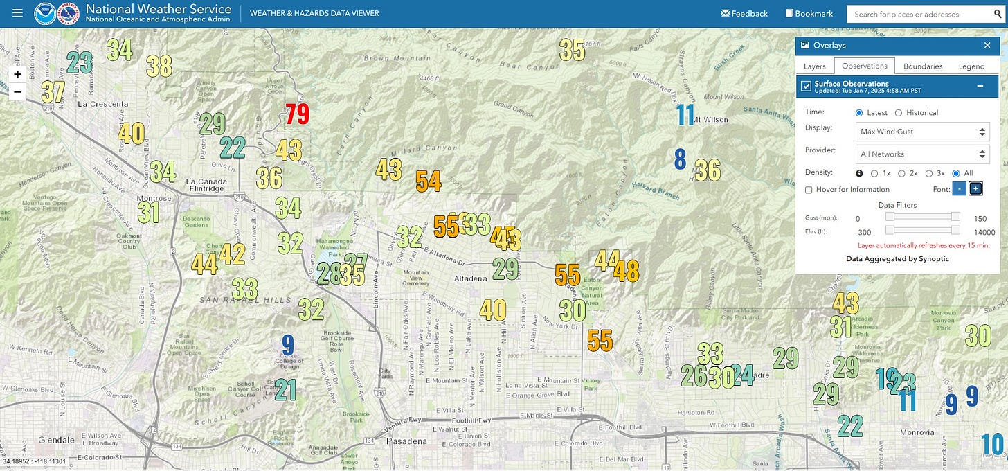
Gusts this morning clocked in at 55MPH in town and 79MPH a little further up the hill. We had a brief lull in the wind as expected today just after 10am almost as if on clockwork, but the respite was brief with the wind whipping up again after 1pm as we gear up for tonight’s round of wind that’s expected to be significantly stronger with those 45MPH winds nearly doubling and gusts exceeding 100MPH, 115MPH up on our mountain ridges.
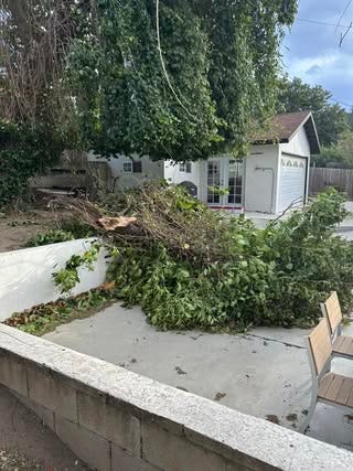
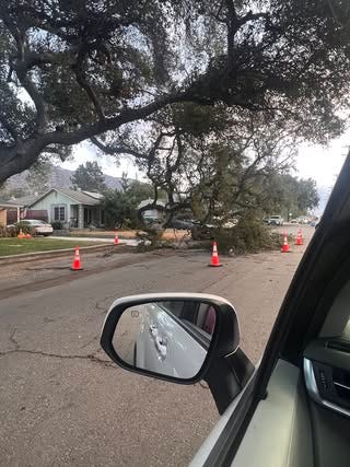
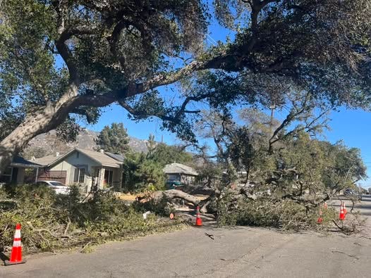
A significant number of trees have come down and by the time this over, we will have lost hundreds of our critical trees (more to come another time about that and what we can all do help replace them).
Power outages are widespread. Some who lost power early and had it restored have reported it’s down again with this afternoon’s gusts. Others are just now losing powe for the first time today now. We've also had reports from people in the Altadena / Lake area, the Kinneloa Mesa area and Maiden Lane area that SCE has notified them that power will be turned off as a Public Safety Power Shutoff in the next few hours and won't be back up until Thursday.
Most area schools chose to close today, the exception being PUSD and it looks like many if not most will be closed again tomorrow. Both LA County and the City of Pasadena both closed non-essential buildings, programs and services today and urged everyone who can to please stay at home and off the roads to make way for emergency vehicles unless you absolutely have to go out.
Roads are already a mess and driving conditions are unsafe with trees down, debris flying and areas of visibility reducing dust. Dust has been kicking up off of the Hahamonga wash all day but latest reports are that a “wall of dust” has made visibility near impossible on the adjacent 210. Expect all of these conditions to worsen later into the day and overnight.
Wildfires are also blazing out of control across the city including in the Palisades where a fire exploded from 2 acres to more than 200 inside of less than an hour and is now estimated at nearly 800 acres four hours later. And while we are somewhat protected here with burn scars including a recent one from the Bobcat fire, embers travel far and fast in 60MPH+ wind and fire could erupt here at anytime. Be vigilant, clear leaves from gutters, run your sprinklers to dampen things down, have a plan and always be ready to get yourself, your family and your pets out at a moment’s notice. Evacuating? Don’t share that info in public forums but do alert your neighbors.
As previously forecasted the real event is still expected tonight beginning around sundown and extending all the way to tomorrow morning. It looks like it’s going to be a very long night for most of us. What we’ve experienced so far is what’s categorized by our hyper local weather person (Edgar) Weather McGregor as a Class 3 windstorm but what’s headed our way tonight will be Class 4 (the max is a Class 5 which is what we saw here in 2011). Last night and today’s wind was like the outer band of a hurricane but we’re still gearing up for the main event.
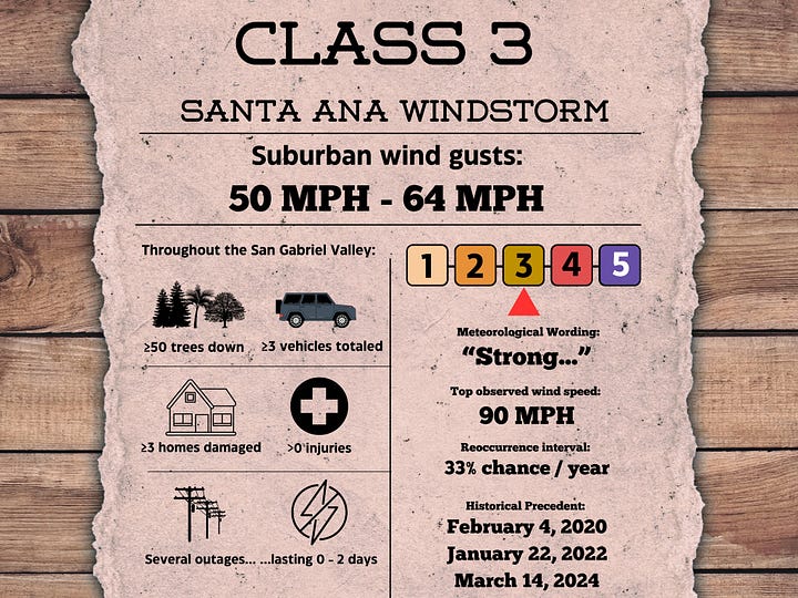
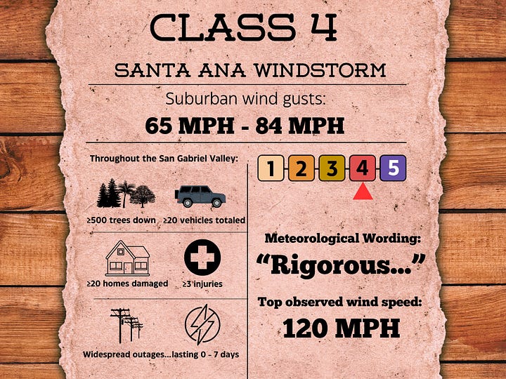
TL; DR: What we saw last night was just the beginning. The worst is yet to come tonight. If you have any damage or discovered any weak spots in your prepping, or do not have an evacuation plan in place if you need one, the time to address those things is NOW. (You can read our Emergency Preparedness Guide too).
The First Round of Wind in Pictures
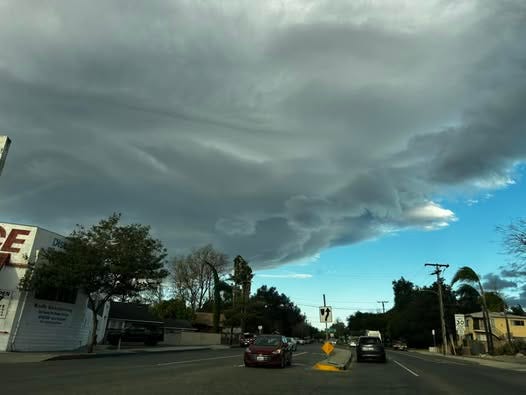
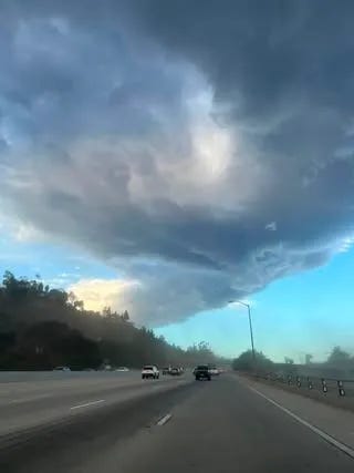
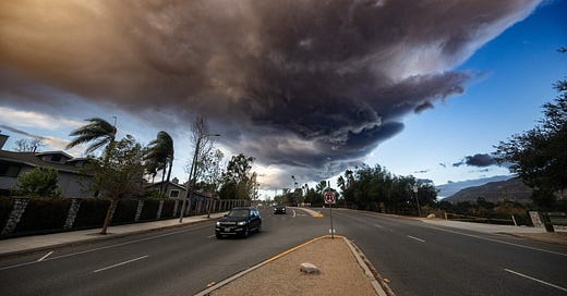
Neighbors shared photos and videos in our Facebook group of everything from the wind roaring to trees down to property damage to the Hahamonga dust bowl to epic cloud formations this morning.

Real Time Updates
For the latest, here are a few of our trusted resources to download or bookmark:
Ready LA County – LA County emergency notifications
National Weather Service – real time forecasts, maps and more
Watch Duty App – real time hyper local fire maps
PulsePoint – local EMS notifications
Weather McGregor – hyper local weather forecasts
Purple Air – real time hyper local air quality
Ambient Weather Network – real time hyper local weather
Bill Westphal’s Weather Camera – hyper local weather station (plus, Mr Bill!)
Dena Lost & Found Pets – hyper local lost and found pet networking and posts
If you happen to be a Facebook user, or have an account you can log into for the next 48 hours or so, we have multiple topical threads in our Beautiful Altadena “Official” Group including:
Power Outage Thread
Lost & Found Thread
School & Business Closure Thread
Traffic & Safety Thread
Windstorm Photos & Videos
… and a whole lot more. If you want a real time place to talk to your neighbors, in a curated and managed environment (that isn’t Nextdoor) come join us there.
We also share important news and updates through our Instagram stories @beautifulaltadena if you prefer to follow us there.
That’s it for now. Signing off. Don’t hesitate to hit reply to this email with any updates you want to share or important questions you aren’t sure how to get answered. Our Subscriber Chat is also open here. The BA bat channel will be live as long as we can keep it live (or I can stay awake!) tonight. Stay safe out there! We’ll see you on the other side.





I saw you had comments about wildfire attorneys on another platform, do you think Alexander Robertson is too small an attorney firm? Can you say why you do not think he can succeed?
Shawna i am trying to ask you a question not sure my message is going through